Mt Adams – June 2013
The weekend of June 21st, a weather window aligned and Brad, Brian, and I headed down to hike up Mt Adams, a 12,281 foot stratovolcano in the south Washington Cascades and the the second highest peak in WA behind Rainier. It’s mostly made of Andesite (and that’s what the rocks on the Lunch Counter are mostly made of) but for all intents and purposes, this was a snow-field climb. The mountain is beautiful, and the south climb is justly popular because it’s accessible and not very difficult.
After surviving miserable traffic leaving Seattle (made bearable by some Kanye West and podcasts), we managed to get on the forrest roads flanking the south slopes of the mountain at about 11:30pm. We somehow missed the main road that leads directly to the trailhead, and ended up off-roading through curvy, bumpy, who-knows-where-this-goes forrest roads in the middle of the night. Brad, his Xterra, and a trusty GPS somehow got us to the trailhead, where we set down a tarp and napped for two hours under the celestial flashlight (it was a nearly-full super moon that night).
Waking up at 2:30am, we repacked and hit the trail. By 4am we reached slick, night-hardened snow, so we donned our crampons and continued to make good time to the Lunch Counter. We gained about 3,600 feet in ~4 hours and made it to the Lunch Counter/Suksdorf Ridge (about 9,400’) by a little before 7am. Along the way we had incredible views of Mt Hood, Jefferson, Three Sisters, and St. Helens, all bathed in morning alpenglow. After taking a break to eat some food and melt some snow for water, we started up the snowfield to Piker’s Peak.
The 2,000 foot snowfield definitely tested our energy reserves. The three of us were staggered about an hour apart, slogging our way up step after step as the sun started beating down on us. Brian arrived first, followed by myself, and then Brad.
Piker’s Peak is the 11,657’ false summit of Adams. To get to the summit proper we had to get up another 600 feet on the final snowfield. Unfortunately, Brad wasn’t feeling too hot at Piker’s Peak, and decided not to agitate his headache further. Instead, he waited for Brian and I while we tagged the summit (he’d climbed Adams before). The two of us set off and made the round trip in about two hours, arriving at the summit right around noon.
The descent was probably one of the most fun I’ve experienced. Adams is known for its glissade chutes, and while they weren’t the water slides that develop by August, there were already clear tracks for where climbers sit and slide down the 2,000 foot south face from Piker’s Peak to the ridge.
Wearing a trash bag like a diaper, I sat in the chute and descended in about 10 minutes the same slope that took us nearly 3 hours to get up. It was a total blast, and as a cloud layer moved in right around the ridge, it was surreal to slide in from a sun-covered peak into the foggy and overcast lower half of the mountain.
Once past the ridge the descent was uneventful—a few more glissades on ash covered snowfields (from a forrest fire last year) got us back to the trail, where we made it back to the cars by around 4pm. The climb took us a bit more than 13 hours round trip.
The next morning, breakfast at Egg River in West Hood River sent us on our way back home, and I had most of Sunday to get ready for the week. Not bad!
Here are some photos:
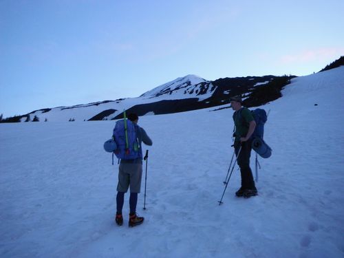
Brian and Brad with Adams in the background
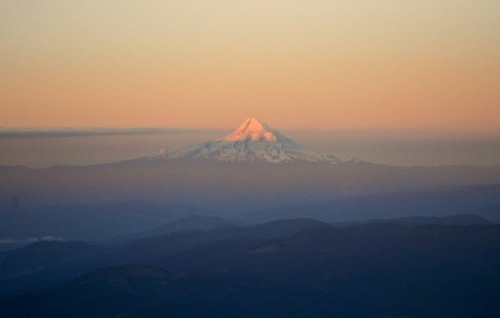
Mt Hood at dawn
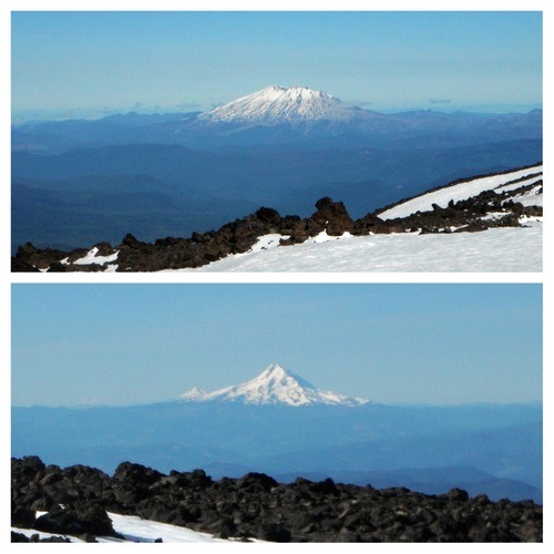
Mt. St. Helens, and Mt Hood
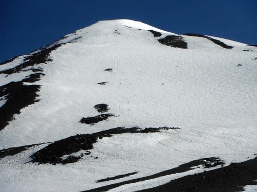
The face to Piker’s Peak

Summit Views