Mount Rainier Attempt – 2014
I’ll start this trip report with a brag: Katy and I have a killer view of Mt. Rainier from our apartment.
Context for the brag: as two people who spend a decent amount of time outdoors and in the mountains, it’s brutal to see that gorgeous mountain on clear days and not be able to say “I’ve been on top.”
Luckily, we have a great crew of friends who feel similarly. July-4th weekend, 1 year after Katy, Brad, and I climbed Mt. Hood, we added Christian to the mix, packed the car, and started driving south.
Mt. Rainier is a 14,409′ stratovolcano, and is the highest point in Washington. On clear days it dominates the skyline in NW Washington. It’s a staple symbol for the state, showing up on everything from license plates to our cheap-drink of choice.
After the usual brutal Friday-Summer traffic, we had an entertaining camp at Alder Lake Campground (4th of July and beers really brought the best out of our neighbors!), and woke up early to pick up permits and make our way to Camp Muir at 10,188 feet.
We decided we’d save some time both on the ascent and descent by skinning up and skiing down, so off we went, at a decent pace at first, and then suffering through the last 800′ in hot sun, with under-trained quads.
Kaytlyn and I made it up first, with Brad and Christian coming up not long after–all of us pretty spent from the altitude and exertion. After setting up camp and starting to boil water, I finally got a chance to walk around and check out our “basecamp” for a few hours before we’d start climbing.
This was my first time up at Muir — it was interesting seeing the diversity in the people who were visiting or spending the night. There were unprepared and over-prepared day hikers, skiers trying to get their July TAY in, and a mix of seasoned alpinists and “what’s-a-glacier?”-type adventure seekers who’d be guided up by RMI.
I’m not entirely sure where we fit into that mix — between the four of us we’ve certainly done a decent amount of climbing, alpine climbs, skiing, and mountaineering. Brad had already summited twice, Christian, Kaytlyn and I had a decent amount of alpine experience (though we are very much still learning), and the four of us had just completed a Crevasse Rescue Course with the Mountaineers. We were feeling pretty good about our skillset and how we function as a group, but Rainier, despite the popular route we were choosing to take, is a serious mountain.
After eating some Mountain House dinners, we passed out around 6pm, planning for an alpine start at midnight.
By the time we got up roped up, it was a bit later than our plan. We were behind most of the groups, but we carried on, setting a comfortable pace up and over Cathedral Gap and onto the Ingraham Flats.
We took a short break here to fuel before the next big section. After a few cold minutes we were again off, moving up the Disappointment Cleaver — a rocky, decently steep, chossy ridge that splits the Ingraham and Emmons glaciers. The sun began to come up about halfway up the Cleaver — a sign that we were way behind schedule.
Dusk was breathtaking — the sun lit up the clouds and basked everything around us in red and orange hues. We took a quick water break at a safe rest spot as first light hit the mountain. It was unreal.
As we got to the top of the cleaver, at 12,300, we noticed a shift in weather: there was now a lenticular cloud circling around the summit. We took yet another rest at the top of the Cleaver, this time to talk about our timing and our plan. As we paused, a set of climbers on their descent went past us. They were covered in Rime, and said that the summit was windy, cold, with zero visibility.
As a group, we decided to turn around. Key factors that lead to this decision:
– It was late in the day. The sun and temperatures were rising, so rock fall hazard would increase.
– Some of us were tired and affected by altitude, which made the going slow.
– The lenticular on the summit was a safety hazard in combination with our energy levels, and we didn’t want to be on the more crevassed upper part of the route in inclement weather
Ultimately, the mountain was going nowhere, and it’s never, ever worth risking our safety for the summit.
We turned around and slogged our way back down the Cleaver, over Cathedral Gap, and back to Camp Muir. Defeated by our timing, preparation, and the weather, we crawled back into the tents at Camp Muir and rested for an hour or so.
After waking up and packing up, we donned our skis, and started heading back down to our cars in the Paradise Lot. Skiing with 50-pound packs is already an adventure, but when your legs are tired from attempting to climb a mountain, it was especially tough. We had great, effort-requiring turns on the snowfield, but things got sloppy for me below Panorama Point. I fell a few times, and was happy to see the parking lot before long.
Looking back at the mountain from the parking lot, the lenticular looked bigger and worse. The storm that kicked us off wasn’t letting up, which reinforced our decision. Plus, we were safely back at the cars, which is always a good place to be regardless of summit success.
We packed our gear back into Brad’s X-Terra and began the drive back to Seattle, recapping our lessons learned and getting excited to come back, apply our learnings, and hopefully summit next time.
–Below are some photo highlights.
The rest of the album can be found at: https://www.flickr.com/photos/elygerbin/sets/72157647062346830
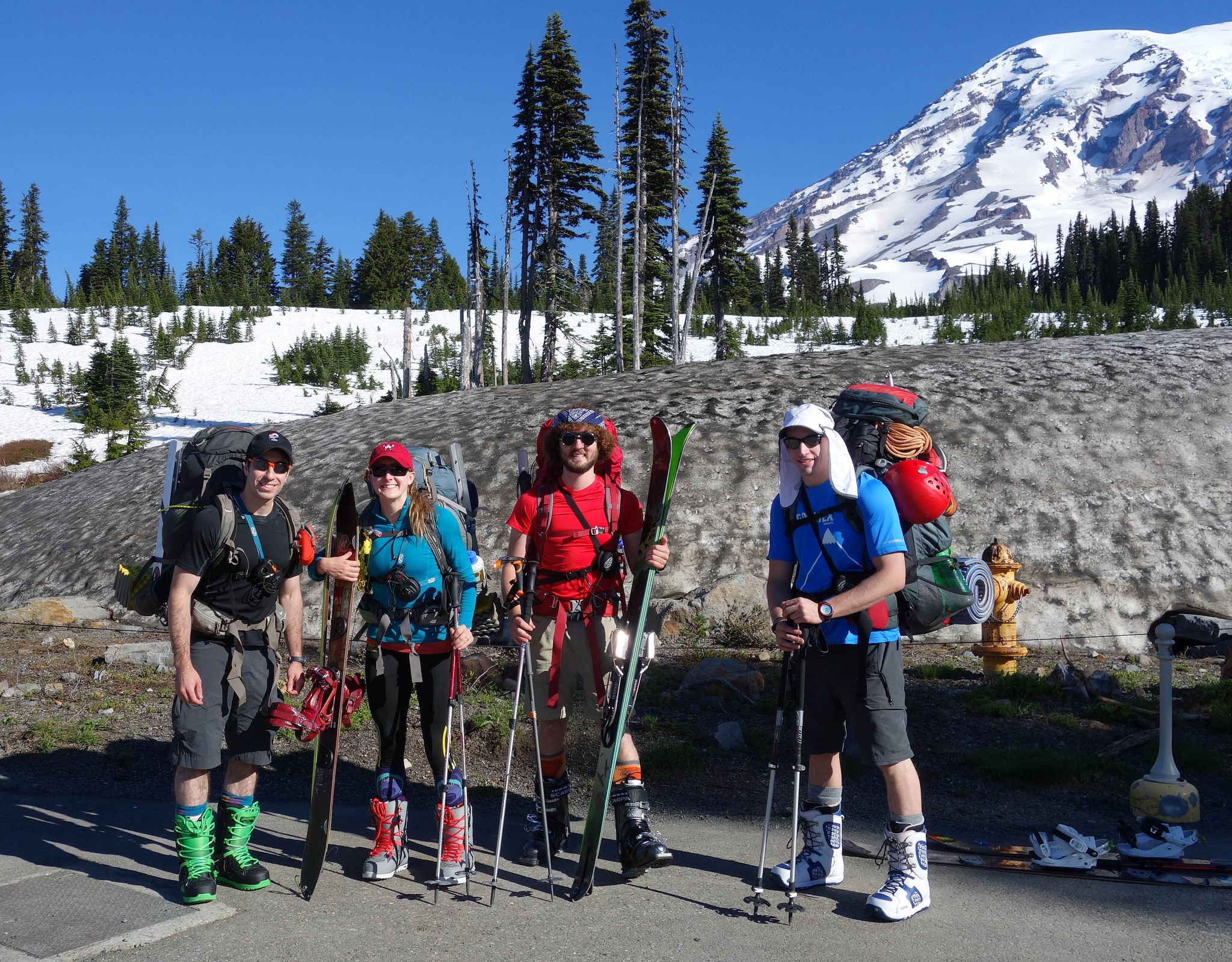
The group.
L-R: Myself, Kaytlyn, Christian, Brad
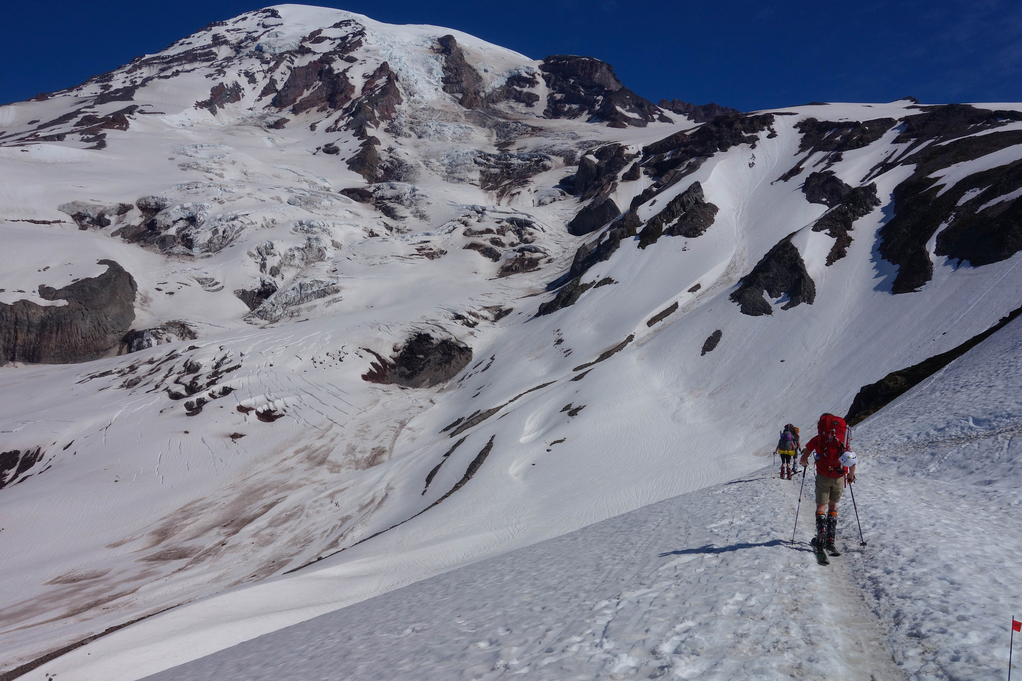
Skinning Up to Muir
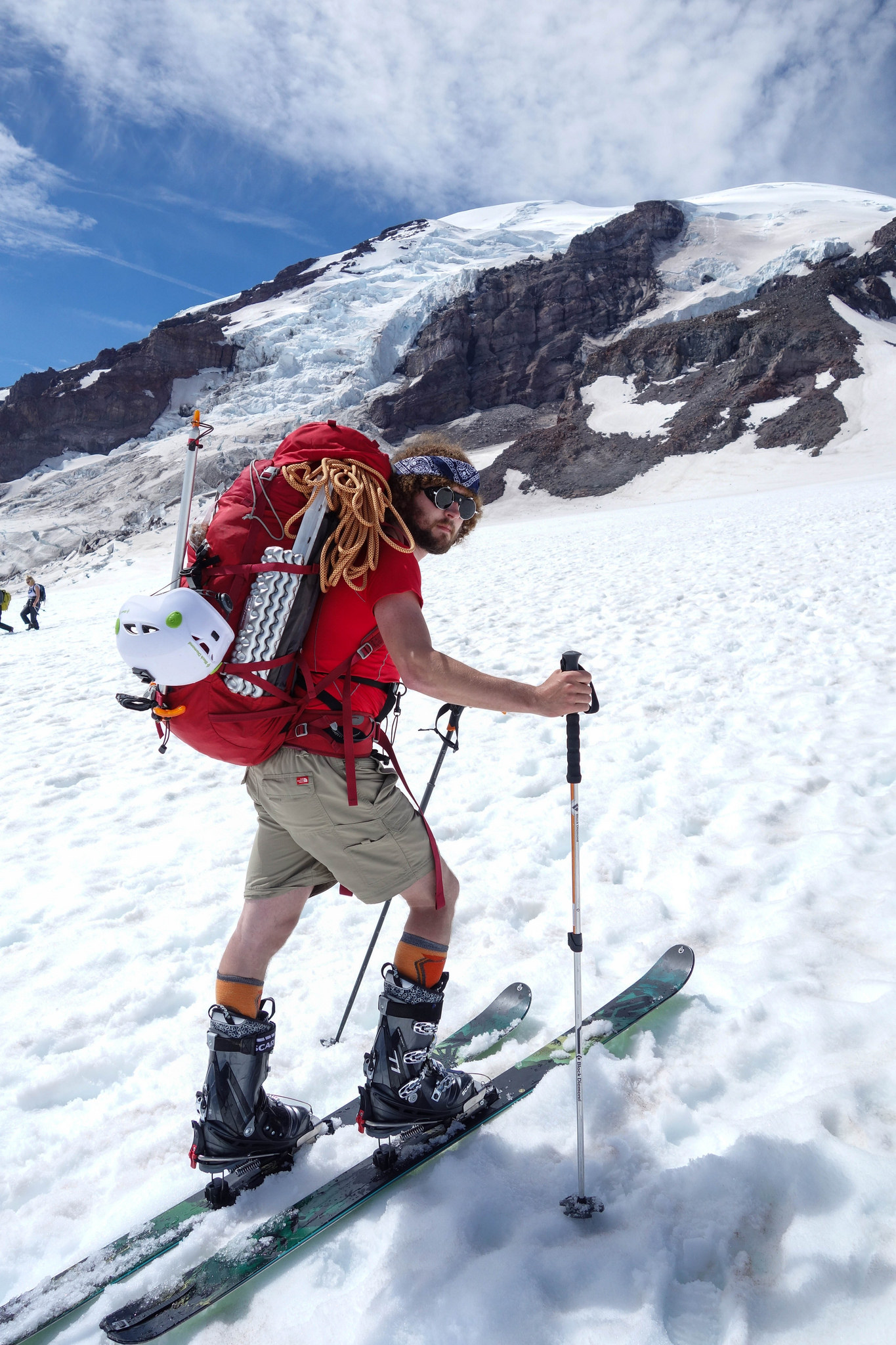
Christian looking epic on Muir. We took “photo breaks”, but really, we were just catching our breath.
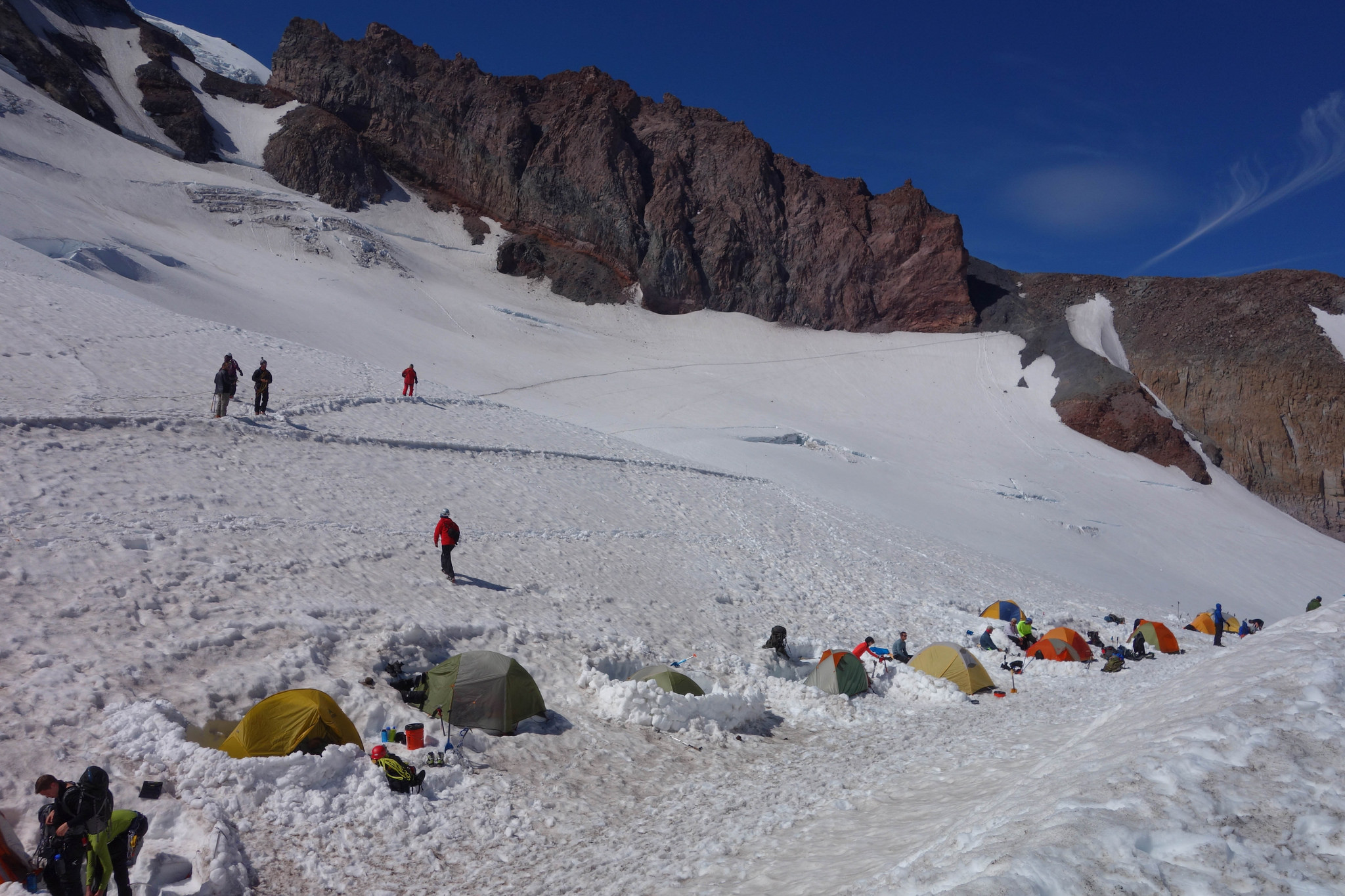
Camping at Muir. Tons of people.
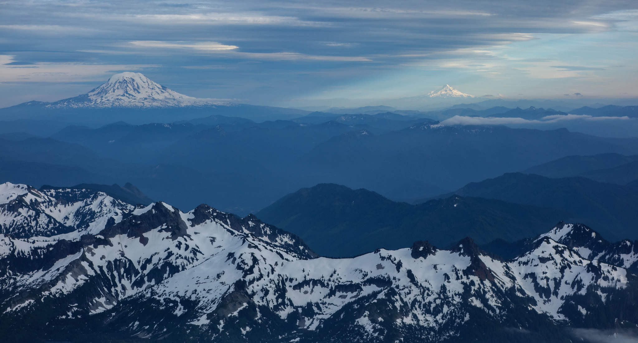
Evening view from Camp Muir
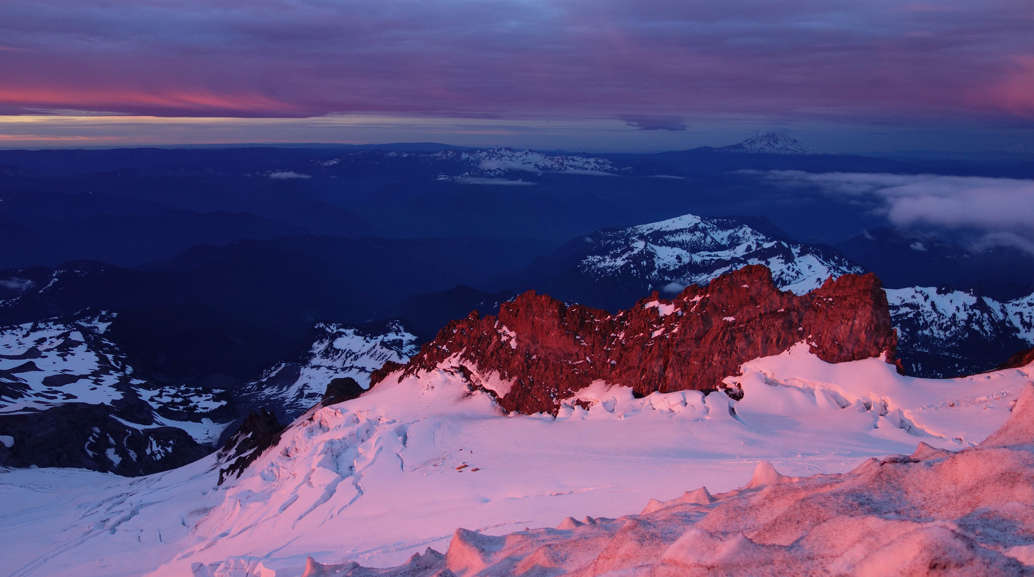
Morning alpenglow on the Ingraham glacier and Cathedral gap (left) and Cadaver Gap (right)
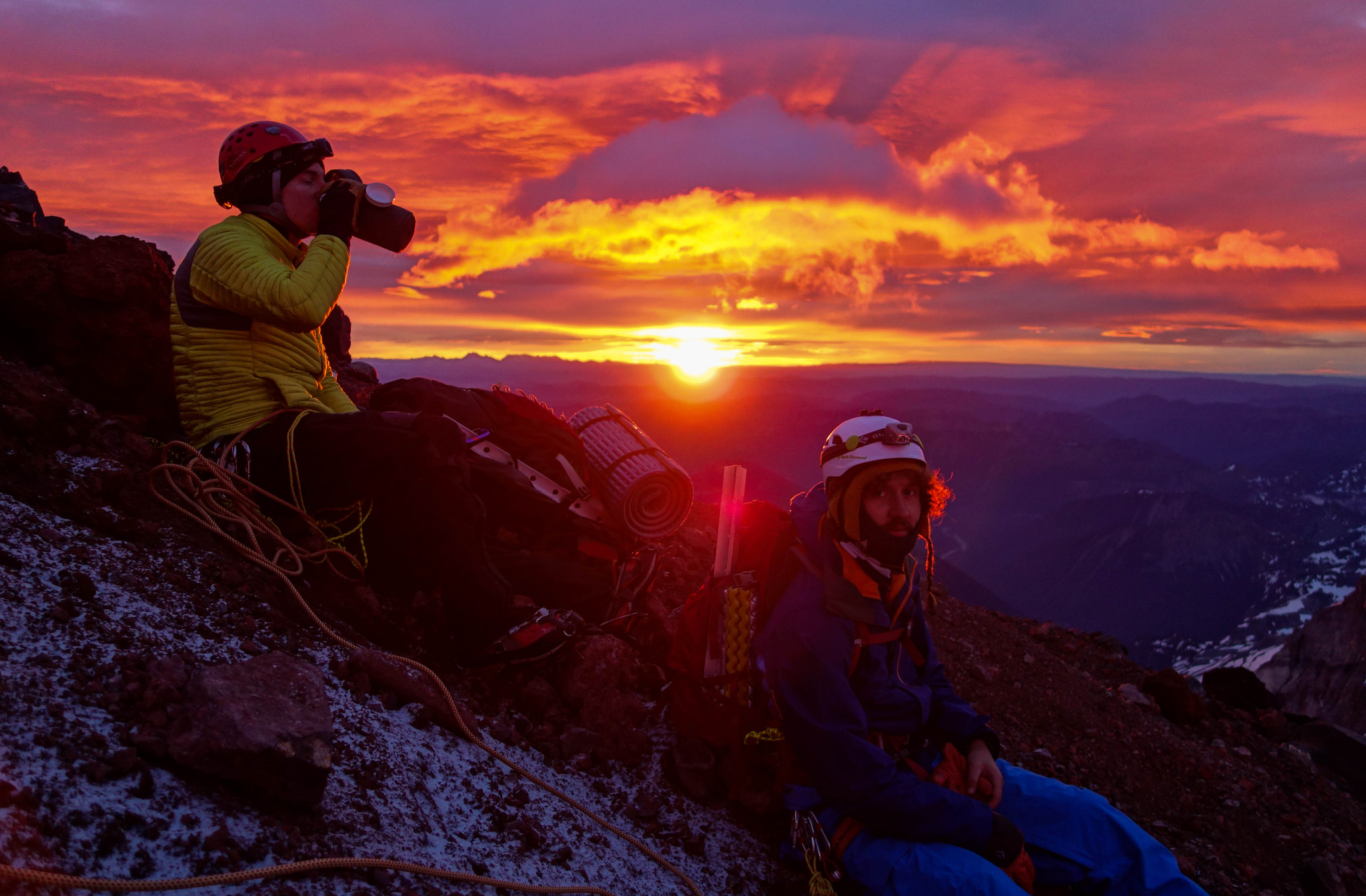
Christian and Brad taking a quick break during sunrise.
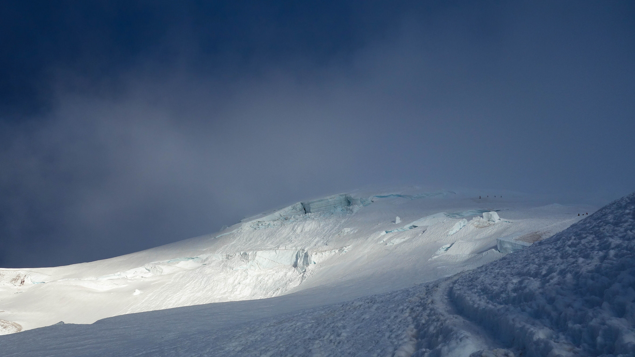
Rainier, with the lenticular beginning to form. Still lots of people higher on the route — many of them on their way down regardless of summit. Taken at the top of the Cleaver, where we turned around.

Skiing down from Muir. The weather on the summit only got worse.